Using the historic map layer
Have you used the ‘historic map’ layer on the Ancient Tree Inventory map?
The historic map layer shows an early-version Ordnance Survey map. This layer features several historic maps that have been seamlessly stitched together, that date between 1860 – 1890.
When looking for old trees, it can be useful to switch between the historic map and the modern satellite image. If you have found a tree that appears on both maps in the same location, then it is possible that you have found a tree that is older than 130-150 years of age.
Comparing the satellite view with the historic map can be particularly useful when:
- Looking for old trees along land boundaries and within hedgerows
- Looking for old open-grown trees outside of woodlands
- Looking for areas within the landscape that may have changed little or be part of historic landscapes, such as scattered trees within wood pasture or old avenues.
See below for some simple steps on how to use the historic map layer on the ATI:
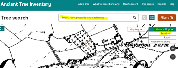
Step 1: Open the Ancient Tree Inventory map
Click this link to open the ATI map. Search Location using postcode (see highlighted box in diagram below) and zoom into the map using the aerial mapping. (See the drop down mapping layers on the right hand side of the screen highlighted, you can click between these layers to compare the historic map with the modern-day satellite map).
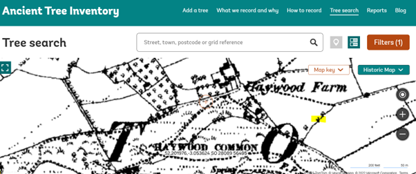
Step 2: Look for trees on the historic map.
Individual trees can be seen on the historic map, look for the small tree symbol (see highlighted example below). Broadleaf trees and coniferous trees are given a different symbol.
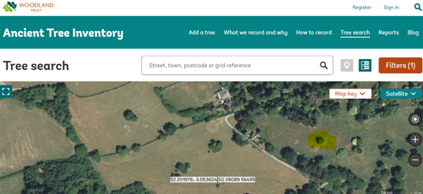
Step 3: Switch to satellite map to see if the tree is still there today
Look carefully to see if the trees appear to be at the same location. In some cases land-use and land boundaries may have changed since the time that the historic map was created. In this example, the tree was clearly growing within a land boundary. On the satellite image, we can see a tree that appears to be in the same location, but the land boundary now doesn’t exist / is not clearly defined (see highlighted tree on map).
Tip: You will not be able to zoom-in to the smallest map resolution on the historic map layer. If the layer isn’t loading, try to zoom-out slightly and the layer will then load.
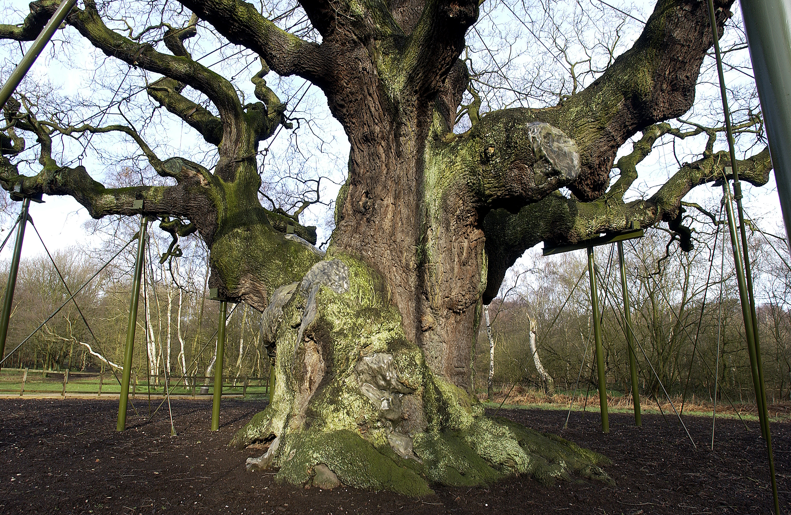
Example: Ancient alder 27696
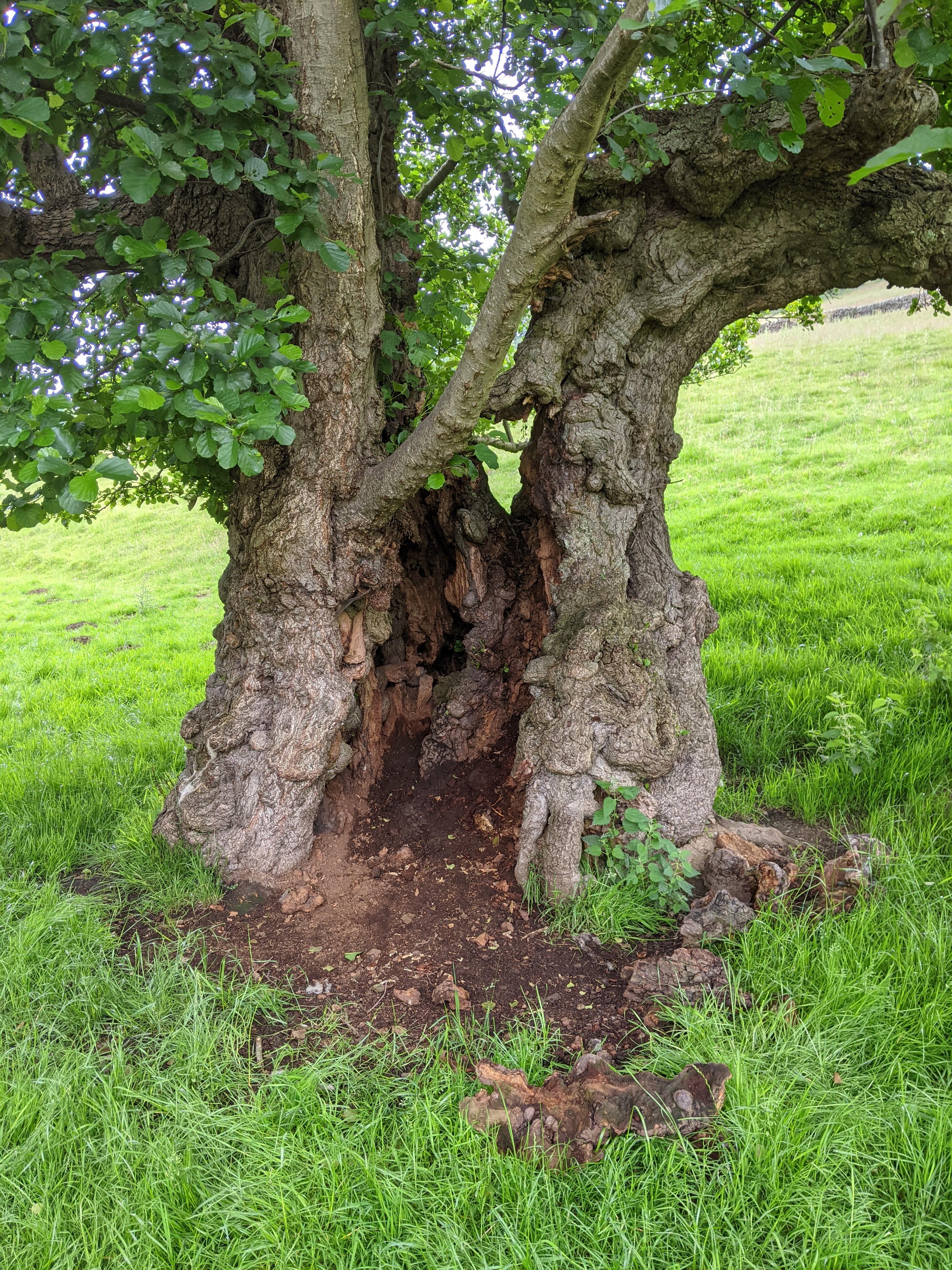
An image of an ancient alder tree (27696). Credit: ATI recorder
This example shows an ancient alder tree that is visible on both the historic map and the modern satellite image (tree 27696). Note: this method of comparing maps is especially useful for identifying those tree species which typically grow to bigger sizes (such as oak, beech and ash), as it is more likely that these trees were big enough to be noteworthy if they were already mature at the time. This method is less useful for individual trees within woodlands, but works well for trees growing outside of woodlands.
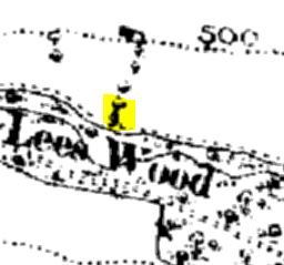
Historic map showing the location of the ancient alder (27696)
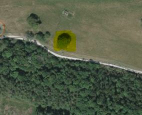
Satellite map showing the location of the ancient alder (27696)
Case study: Not all veteran trees will be visible on the historic map!
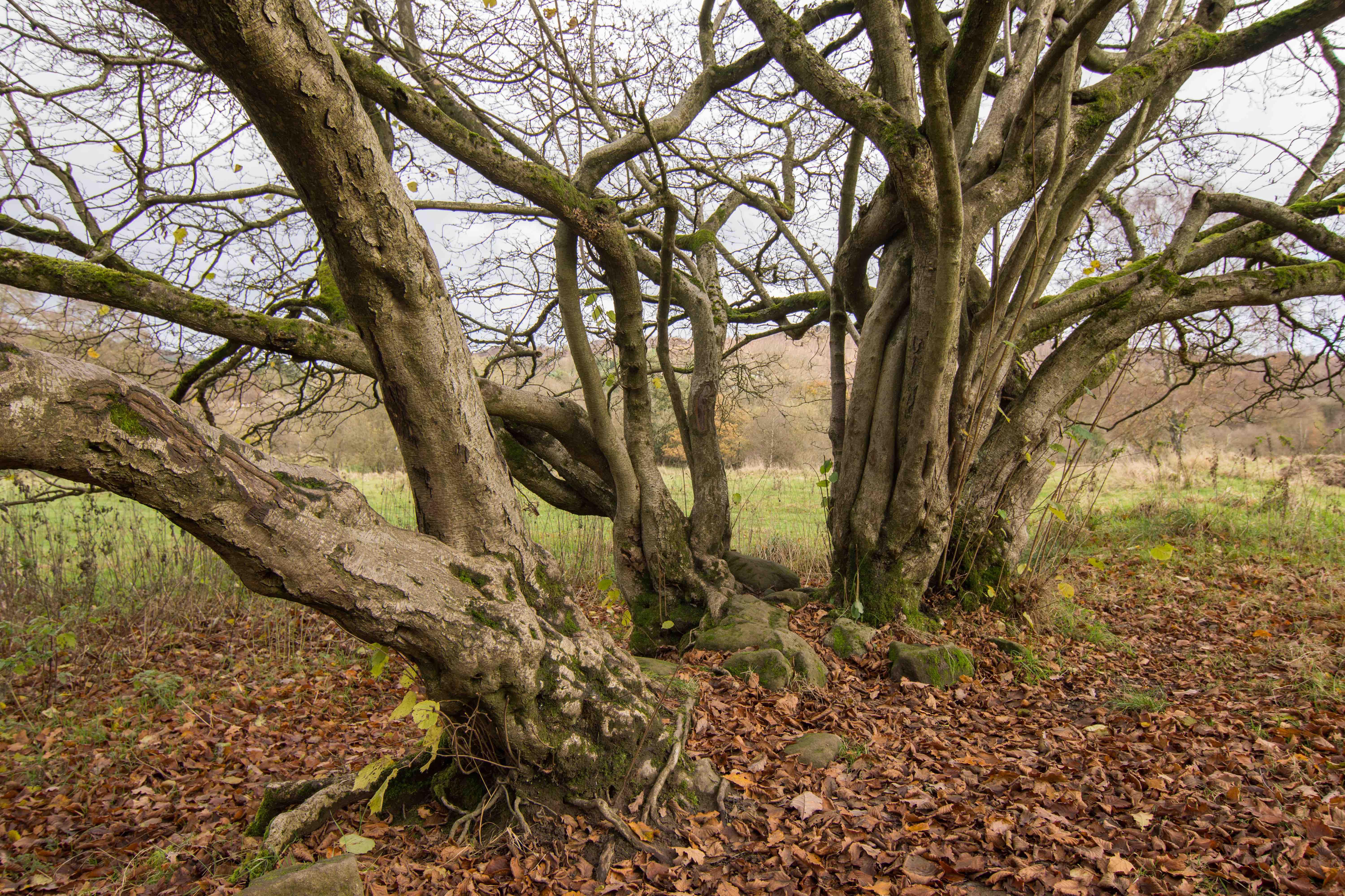
A veteran hazel (212115) at SK2460677612. Remnants of an old dry stone wall are visible within it's roots, indicating a link to a former land boundary. Hazel are one of several smaller-growing species that are often linked with former land boundaries. (Tom Reed)
The maps below show a satellite image and a historic map for the same location (see highlighted locations. There is a veteran hazel visible on the satellite image, but this does not show on the historic map. On the historic map we can see a land boundary that runs exactly through the centre of where the hazel tree is today. In the photos of the hazel tree, we can see the remnants of a dry stone wall within the roots of the tree and it is on slightly raised soil, so it is likely that this tree existed at the time of the old land boundary. At the time of creating this historic map, this hazel tree may have been too small to be worth marking on the map! Keep in mind that important smaller veteran trees such as these may not appear as marked trees on the historic map.
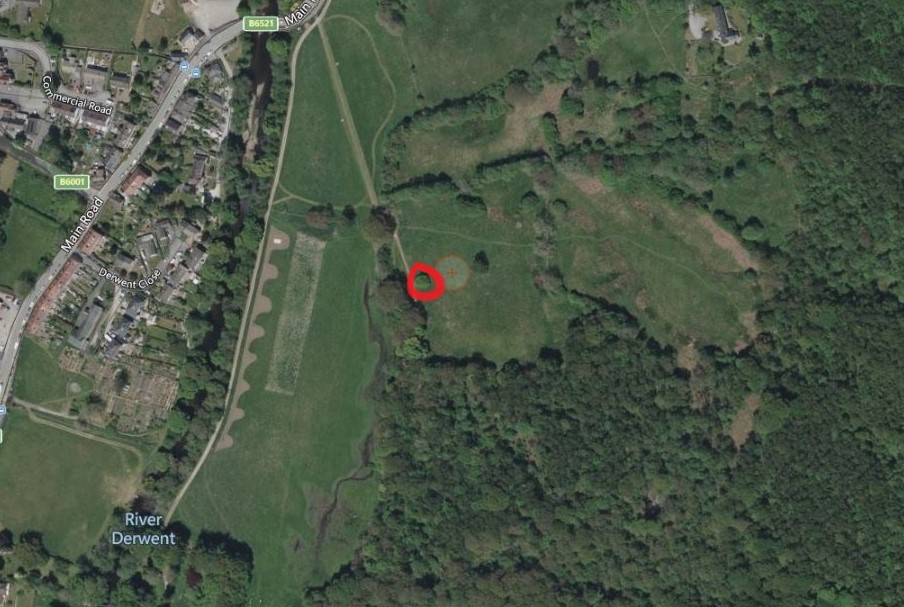
A satellite image showing the location of the same veteran hazel (212115). See red circle.
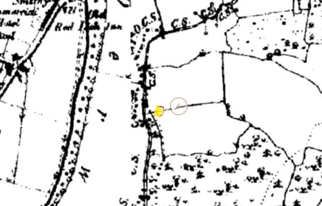
A historic map showing the location of where the same veteran hazel (212115) is located today. The tree may have been growing when the land boundary existed, as species like hazel were often planted to help mark land boundaries. It is possible that the tree may have been too small to have been noteworthy to the cartographers in the 1800s or simply had not been planted at this time.